SEVERAL RECENTLY DISCOVERED SUPPOSED ASTROBLEMES IN DALECARLIA, SWEDEN
Version 4.4

Download printable complete version in pdf-format (24 MB)
Part 3
7.4 THE LAKE LÅNGSJÖ-ASTROBLEME
The Lake Långsjön-astrobleme has its centre at (Pos. X) and a radius of 4,25 km. Roughly 180˚of its perimeter consists of the lake or of lowland with parallel isohypses. The whole area is covered by forest; for this reason searching for impactites is very difficult.
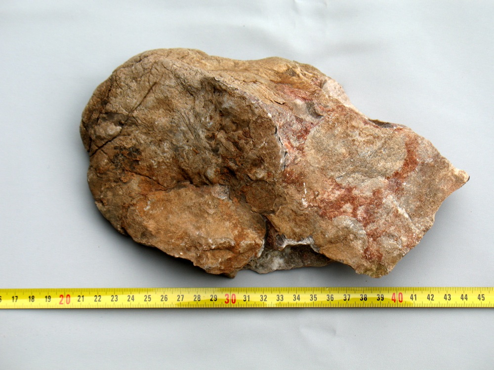
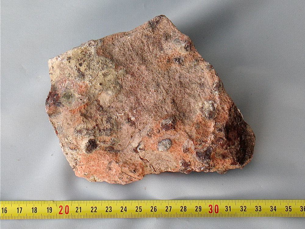
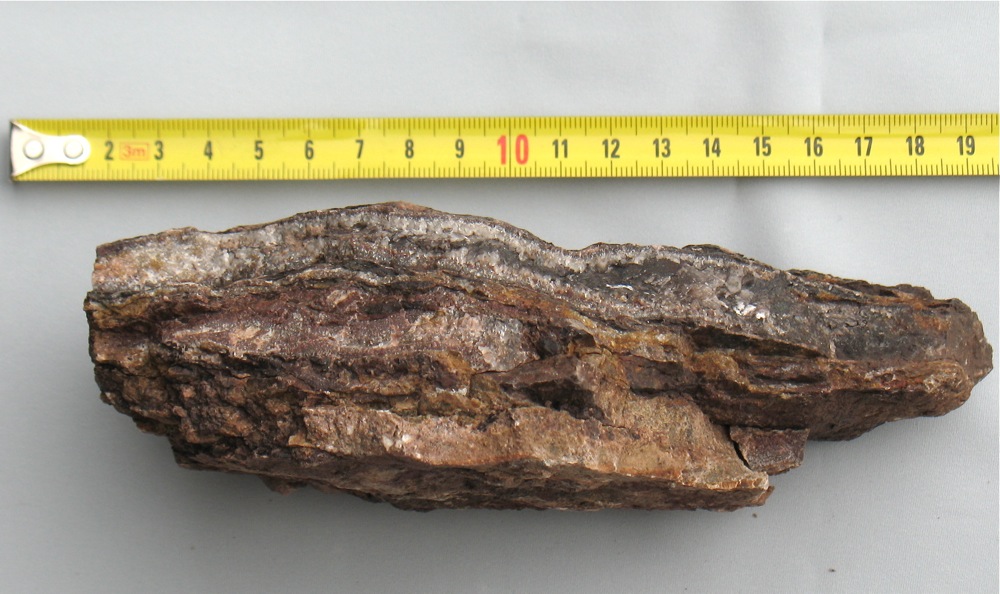
However, about 1 km inside the perimeter there is a quarry at (Pos. Aa), which is very rich of pseudotachylites (here thin layers of a brown melt or a brown precipitate between blocks of bedrock, that have sledded on one another), of pieces of shatter cones, of now exposed surfaces, where the sliding can be seen and of quartz-cured crushed granite, see Fig. 19a. Note the melt phase between the two quartz veins. Evidently later the blocks on opposing sided of the tachylite have separated somewhat, allowing quartz-saturated water to penetrate the crack. Tectonic movement is far too slow to generate so much cracks and glass and does not generate crushed granite, which later on is sealed together by quartz solutions in water.
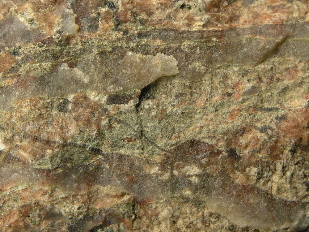 |
| Fig. 19a: A melt phase between the two quartz veins. |
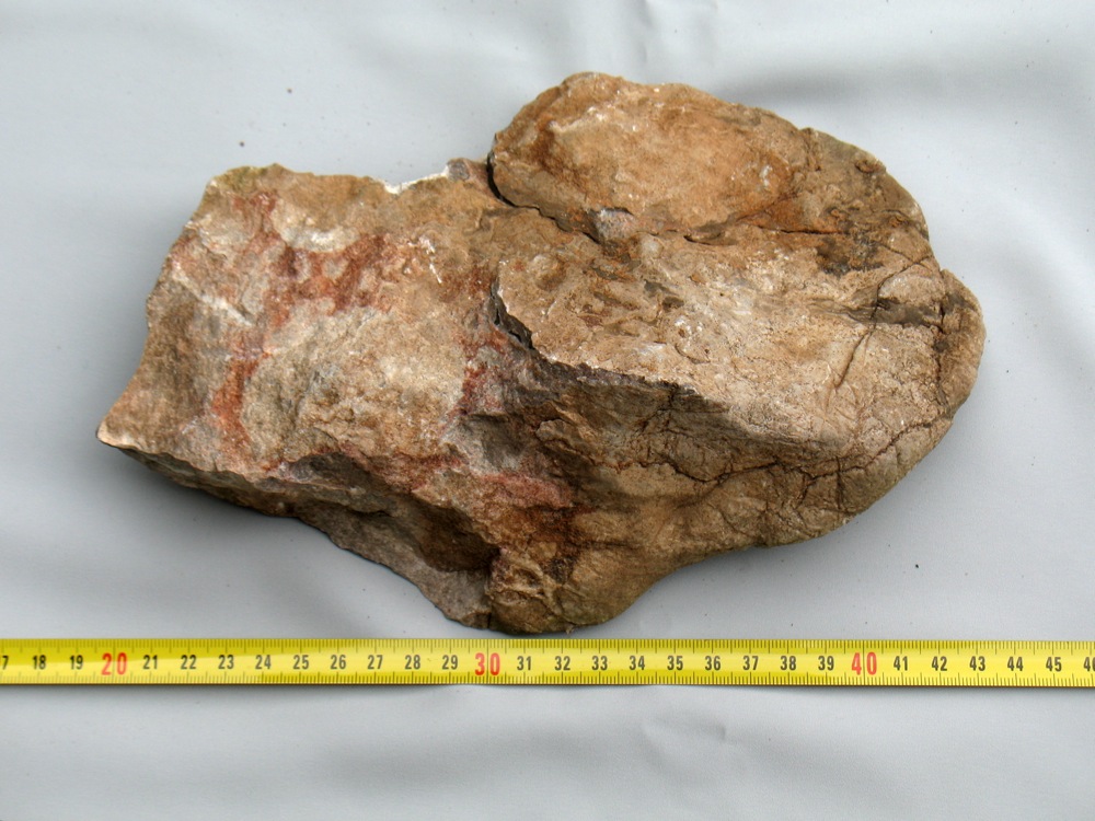
During blasting in the quarry the rock sometimes separated at old cracks, thus freeing the tachylite. This is normally 1 mm thick, can reach up to 5 mm. In such melt fillings small grains of other rocks are seen, indicating that this melt has been pressed in from a distant position. A prerequisite for this mode – distant transport – requires the rock to be hot, i.e. heated by adiabatic compression. See Fig. 19a, 19b and 19c. At the entrance to the quarry there are two boulders to prevent the access. Check these: They contain plenty of thin dikes with brown melt.
Somebody might suggest, that the ‘pseudotachylites’ are due to simple filling of cracks by mineral-rich water. This cannot be the case, since water never would leave gas bubbles in the ‘sediment’. Recently (autumn 2009) new blasting in this quarry has taken place.
 |
| Fig. 19b: Layer of pseudotachylite, quartz-rich side, 5 mm thick. |
 |
| Fig. 19c: Same pseudotachylite as in figure 19b, the rear side rich in melt. |
 |
| Fig. 19d: Two pseudotachylites about 5 mm thick. |
There exists much evidence for that the bedrock in the quarry has been affected by an impact. This could be an impact by itself (the Långsjö-astrobleme) or due to the damage done by the Siljan-astrobleme. Concerning this latter hypothesis we have to look for positions of the same damage at similar distance from the Siljan-astrobleme.
Disregarding the damage to the bedrock and its tilting inside the ring there is evidence of tilting in the exposition Kårgärdet, about 1,5 km NE of the Orsa railway station. Here the Ordovician limestones and the local porphyry are raised up to 70˚; the distance to the centre of the Siljan-astrobleme is 18,7 km. The next expositions to the east – the limestone quarry Kallholn – is at the same distance, but practically not affected. The last exposition at Kallmora is at a distance from the centre of 19,2 km. There, a fine-grained sandstone (Orsa-sandstone) from upper Silurian, is not affected at all.
The quarry at the supposed Långsjö-astrobleme is so far as 37,5 km from the centre of the Siljan-astrobleme. If we cannot find additional sites of damage at a similar distance due to the Siljan-astrobleme we have to assume, that the Långssjö impact is an astrobleme of its own. This in turn strengthens our hypothesis that several of the other investigated supposed astroblemes are in fact real astroblemes.
Within this supposed astrobleme there are two further sites of finds. The one is a forest road north of Gäddtjärn with coordinates according to (Pos. At). There in the sand of the road filling stones affected by an astrobleme are found. Near the road very many giant boulders are seen.
The other site is a gravel pit (Pos. Au), which most probably has furnished the gravel to above road. There are so many boulders in the gravel, so they had to be blasted. These rocks look like reconstructed granite with constituents, not normally seen in granite.
A further site inside the Långsjön-astrobleme is at (Pos. Bd). This position is that of the forest road nearby. Here forest ploughing has taken place and unearthed many stones and boulders, which have been affected by an impact. One of the boulders is a breccia, welded together by a brown melt.
7.5 THE LAKE VÅDSJÖ-ISRAELSSJÖ ASTROBLEME
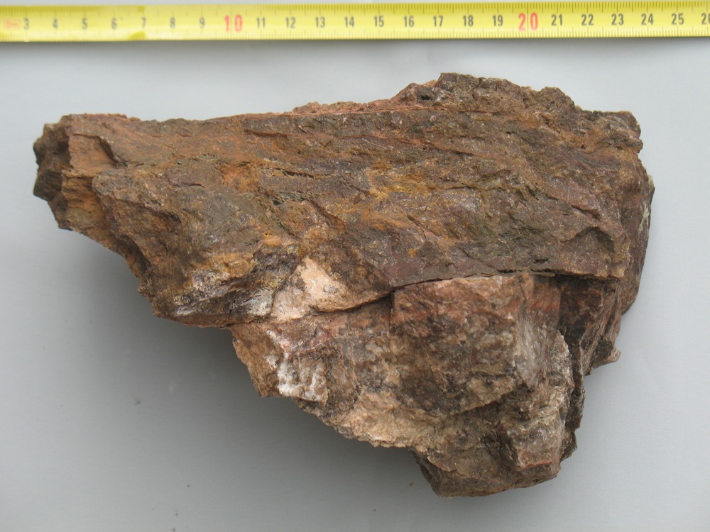
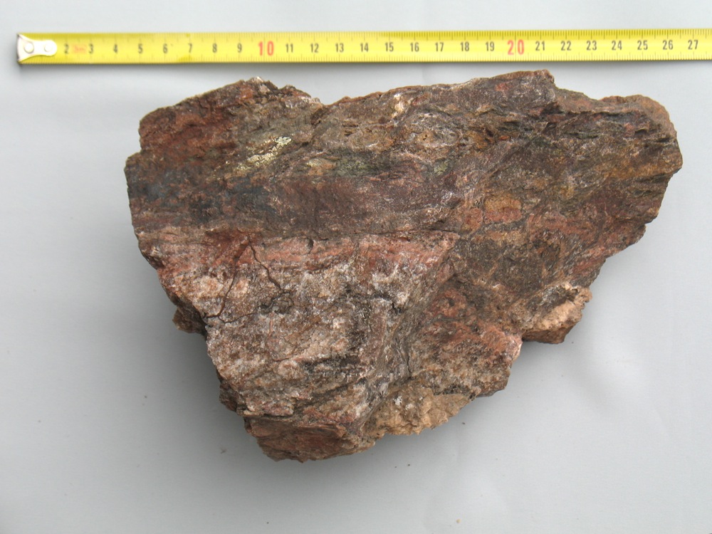
The centre of this supposed astrobleme is at 13 km west of the church at Siljansnäs at (Pos. S); its radius is 3 km. During the first inspection this author reacted upon the rich vegetation along the small river Långsån, which indicates carbonate. This could be due to local residues of the former carbonate cover or material from the nearby Siljan-astrobleme, conveyed there by the Holocene ice. At (Pos. T), in a gravel pit, a large fraction of the boulders is affected by an impact. Pure melt is rare, as shown in Fig. 20; Fig. 21 shows the cracked and quartz-cured rock. However, in a nearby large gravel pit at (Pos. U), about 3,5 km south of (Pos. T), impact-affected boulders are missing. Therefore those from (Pos. T) can be local.
 |
| Fig. 20: Layer of melt through granite. The thin white band is a late quartz impregnation along the old fracture zone (Pos. T). |
 |
| Fig. 21: In all directions cracked and quartz-cured granite (Pos. T). |
A further site for finds is a forest road, leaving a larger forest road at (Pos. Y) and climbing up to its end at 340 m height. Along this road impact-affected material can be found. One find is a block of brown coloured (former) quartz jelly, which contains silicified pieces of the stem of a crinoidea, Fig. 22.
 |
| Fig. 22: Silicified pieces of stems of a crinoidea in quartz-rich matrix. |
 |
| Fig. 23: Metamorphosed melt (Pos. Z). |
A further site of finding is a gravel pit at (Pos. Z), where only one interesting piece of a metamorphosed melt has been found, Fig. 23. This piece could originate from the Lake Siljan-astrobleme.
At Lake Vådsjön there starts a canal for water transport to a hydropower plant; it is cut out of the rock. May be, samples of the local rock could be found there. Up to now the nature of this ring is not completely clear.
7.6 THE SILJANSNÄS-ASTROBLEME
South of the village Siljansnäs there is a lake communicating with Lake Siljan. It is almost divided in two by an island; the western side of the lake is called Alviken, the eastern side Byviken. Around this lake there is a chain of hills. If it wouldn’t be for the rich occurrence of carbonate-preferring plants one might have overlooked this supposed astrobleme and never investigated it. However, even this ring seems to be an astrobleme with radius 1,2 km. The evidence for this is the island, called Storön. This island is elongated, length about 2 km, heading 20˚W, forms a large sheet with strike 20˚W and dip 20˚E. May be one would not react, would it not be for the cliff at its east side. This is about 30 m high and absolutely vertical, called Digerberget. Here we have a tilted sheet, like “Käringberget” inside the town of Leksand.
 |
| Fig. 24: Pseudotachylites at (Pos. Ab). |
At (Pos. Ab), in an amelioration cairn, there are stones with undeniable traces of pseudotachylite, Fig. 24. A further site for finds is near the village Siljansnäs in an amelioration cairn (Pos. Ac).
Since the large Siljan astrobleme is too far away to tilt a sheet, we have to assume, that even the Siljansnäs-ring is an astrobleme. Boulders with impactite marks can have been transported here from the Siljan-astrobleme, but not the tilted sheet in the local lake.
7.7 THE LEKSAND-ASTROBLEME
From Lake Siljan there runs a narrow bay like an estuary to the town of Leksand. From the village Östanhol to Leksand this bay has a curved rim. Southwest of Leksand this depression in the terrain continues into the next Lake Insjön. During a late phase of the most recent Ice-age, when the level of Lake Siljan was about 8 m higher than to day, there was a continuous bay from Östanhol to the east end of the Lake Insjön. This corresponds to roughly 180˚ of the whole perimeter. This was the first indication, that there might exist a further astrobleme, here called the Leksand-astrobleme. Its centre is at (Pos. Ad) and the radius is 8,4 km.
The next indication is a series of tilted sheets in an area north of Leksand. The first and most impressing one is that within the town of Leksand, named Käringberget (Pos. Ae). The name is associated with the burning of witches in the 1670:s at that place. In fact, the place is unusual even from a geological point of view. From the former execution place (to day a parking lot) and 10 m to the west one reaches the brink of a formerly horizontal plate of granite, now dipping at 60˚W and striking 30˚W. The top of this plate is about 75 m above the level of the railway east of it, i.e. above the valley level; the foot of the plate disappears in moraine boulders, see Fig. 25.
 |
| Fig. 25: Tilted sheet of Käringberget, west side. |
Another, similar tilted sheet, is at (Pos. Af), height about 25 m above surrounding ground. There are additional similar and minor cliffs north of Käringberget, all parallel to the supposed ring trough. It is hard to believe that these should have survived since the latest large folding epoch, which occurred during the Paleoproterozoikum. However, they could very well have been caused by a meteoric impact. Therefore searching for impactites started. At South Torrberg several such have been found in an amelioration cairn at (Pos. Ag), pseudotachylites and a reconstructed boulder with 5 cm large potash feldspar crystals. At North Torrberg there is a larger boulder in an amelioration cairn, containing many thin pseudotachylites (a brown melt), (Pos. Ah).
Another site is east of the former railway station Slättberg. There exists older granite, only. Parallel to the public road there is a forest machinery track. These vehicles have crushed the granite by their load; the fracture is often along former pseudotachylites. Here these are very thin, around 1 mm, filled with brown melt. This granite is local, no other (ice-transported) rocks exist (Pos. Ai). Therefore the tachylites also have to be local.
The most interesting place is a quarry near the road Rättvik-Falun at (Pos. Aj). It is situated on the rim of the supposed astrobleme. In this quarry for macadam all types of rock exist: Granite, a rock consisting mainly of coloured quartz and a black dike, to day consisting of chlorite slate (might have been black shales from the Ordovician Tretaspis layer). Also a few pseudotachylites occur, see Fig. 26. Thedistance to the centre of the Siljan-astrobleme is 25 km. The quartz is of a glassy variety, clear but dyed, hard and brittle like pegmatite. Pseudotachylites are few, probably because they have been destroyed later during their life. There is a brown rock, looks like porphyry, with inclusions of cm-large fragments of the chlorite slate. To this author it appears, that the “porphyry” is not at all porphyry, but consists of brown-dyed quartz, which has absorbed fragments of the chlorite slate, see Fig. 27.
 |
| Fig. 26: Pseudotachylites at (Pos. Aj). |
 |
| Fig. 27: Brown dyed quartz with inclusions of chlorite slate (Pos. Aj). |
Most probably we are looking here inside the bedrock on a portion, which had been very hot for thousands of years and percolated by steam. This has broken down remainders of feldspar and changed the Tretaspis layer to chlorite. The question is, if this is due to a local astrobleme (the Leksand-astrobleme), or to the nearby Lake Siljan-astrobleme. The distance from the quarry to the centre of the Siljan-astrobleme – as we define it – is 25 km.
The west side of the road between Sätra and Plintsberg is – due to its richness of hepatica, hazel and orchids - a Natural Park. The biological reason for this is a rich occurrence of calcite in the soil. However, solid calcite rock never has been found. Certainly the calcite originates from the Ordovicium and has been cast there from either the Siljan-astrobleme or the supposed Leksand-astrobleme. Several pieces of suevit and one piece of calcite have been found.
In summary: The sheets of rock, tilted near Leksand and the ring dike west of Leksand point towards an astrobleme of is own; the rocks in the above named quarry point very strongly on heat effects from an astrobleme, but not from which. The quarry is in continuous operation: Therefore the exposed rocks continuously change.
7.8 THE SUPPOSED LAKE LJUGAREN-ASTROBLEME
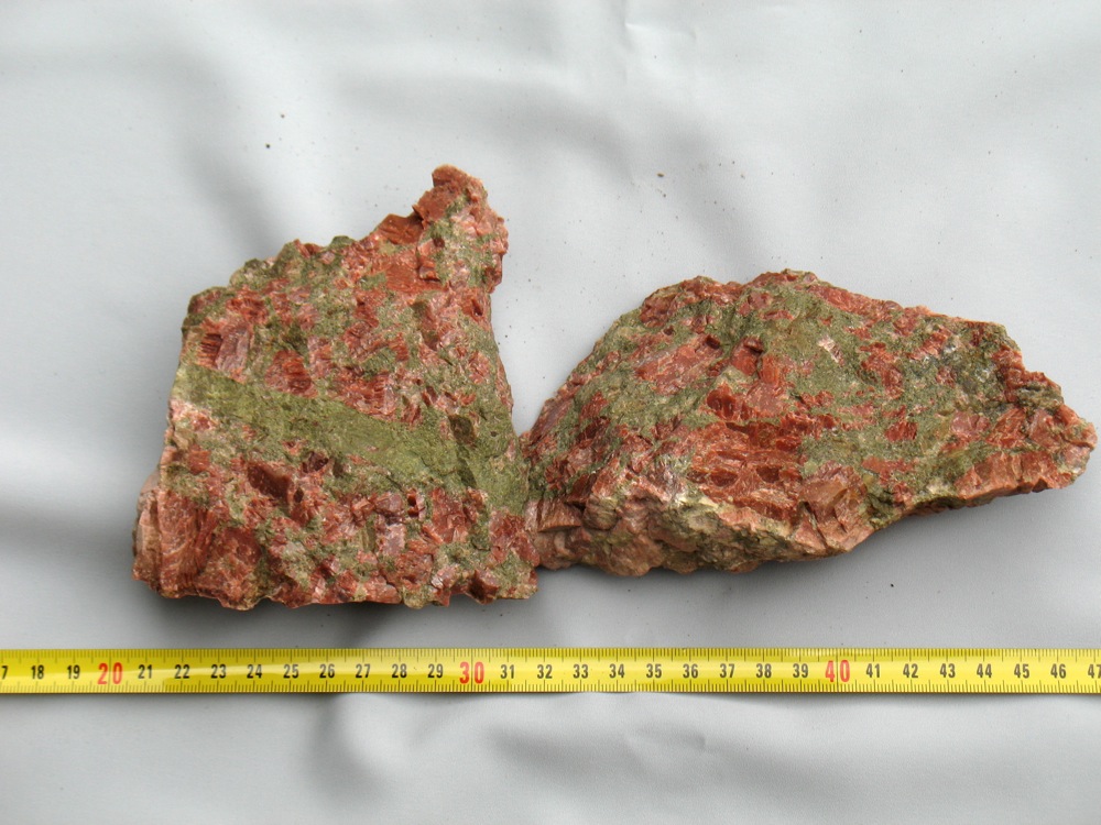
On the topographic map 14F SO Rättvik the lakes Dådran and Ljugaren form a part of a ring-depression. The bedrock map of the Kopparberg County shows – somewhat displaced to the north – a circle of the same size. In the list of rocks this rock is named granite-syenite. This sounds like the crossbreeding of hors and zebra in zoology. In fact in the eastern part of the circular area there is a typical rapakivi-granite, which weathers and crumbles very easily. It consists of several cm-wide potash feldspar crystals, mantled by plagioclase and plenty of hornblende. In the north-western part the rock consists of red-brown microcline of up to 5 cm size and large quantities of light green epidote, only. Some samples are completely free from visible quartz, others contain an insignificant concentration.
At (Pos. Ak) there are large-scale shatter cones to be seen in the boulders on the beach together with dark red pseudotachylites. Such large potash feldspar crystals have been recognized at other sites of supposed astroblemes, might have been developed out of the shattered rock during the time the bedrock still was partly melt due to the chock. Due to the combination of shatter cones and pseudotachylites this site is worth of further investigation.
At (Pos. Bi), about 100 m north of the forest road beginning at (Pos. Bj), there is a block of Ordovician calcite, weighing about 50 kg. It has no detectable layering, consist of a sintered mixture of calcite- and quartzpowder. To survive under geological times it must have been covered by other debris, originating from the fall of the meteorite. Since the border of the Siljan-meteorite is not very far away, it could originate there from or belong to the supposed Ljugaren-meteorite. See Fig. 27a and Fig. 27b.
 |
| Fig. 27a: Reconstructed calcite from north side of Lake Ljugaren |
 |
| Fig. 27b: Reconstructed calcite (Rear side of sample Fig. 27a) |
At the same location there are several boulders, consisting of the brown-red microcline and epidote, only. The epidote is light green in colour and must have been a melt/liquid, since it penetrated the mesh of loose feldspat crystals as a vein. Note that the microcline is definitely darker than normal in granite or pegmatite. The veins contain fragments of the feldspar and of other epidote-minerals like orthite. See Fig. 27c.
 |
| Fig. 27c: Syenite (microcline and epidot, only), formed from calcite powder and rapakivi granite |
The genesis of this feldspar-epidote rock (about 50% of each) we might imagine as follows: Directly after the impact of the meteorite the bedrock got melt or partly melt. This condition lasted for very long times, years or thousands of years, depending on the size of the melt body. During this long time quartz left the system by aid of supercritical water to cooler regions (this is seen in the nearby Siljan astrobleme). The feldspar crystals grew in size by ‘cannibalism’. The residual debris of the previous granite, together with debris from the Ordovician limestone, was attacked by the water-vapour present. Calcite, water and calcite-feldspar reacted to zoisite according to
CaCO3 + 3(CaAl2Si2O8) + H2O ↔ 2(Ca2Al3Si3O12(OH)) + CO2
This zoisite (or epidote) reacted with little water present to an eutectic melt or - with much water present - to a liquid, saturated with zoisite. Both filled the empty space between the mesh of potash-feldspar crystals.
This combination – dark microcline and light-green epidote - is seen in several other of the described supposed astroblemes.
Along the forest road from (Pos. Bj) to the stop for (Pos. Bi), on the west side of this road, there are several bolders, affected by the impact. One of these consists mainly of (previously) pulverised and now sintered calcite, see Fig. 27d.
 |
| Fig. 27d: Sample of reconstructed Ordovician calcite |
7.9 THE SUPPOSED LAKE BALUNGEN-ASTROBLEME
Despite its evident ring shape, consisting of several lakes, up to date only one single find has been made which relates to a supposed astrobleme, viz. a piece of a soevite at (Pos. Al), unfortunately in an esker; this means, that the sample could emanate from anywhere. More research is necessary. The site has been visited only once up to date.
7.10 THE LAKE HUMMELN-ASTROBLEME
Due to very rich finds in the field the prefix ‘supposed’ has been avoided here. There is no doubt, that this astrobleme is a real one. This supports the assumption that several or all of the other astroblemes are real, too.
In Sweden large lakes have only one name, i.e. not the prefix ‘lake’. Examples are Vänern, Vättern, Siljan, Dellen, Mien and Hummeln. The last four names are well known astroblemes. Hummeln is a lake 15 km NW of Oscarshamn. Our Lake Hummeln (Hummelsjö) is a small lake 8 km SW of the town of Vansbro in Central Sweden and 75 km SW of the centre of the Lake Siljan-astrobleme. The similarity of the name and the fact that this lake with a round form lies straight on the line of impact of all the other here described supposed astroblemes made this author interested. The lake is semicircular, with the round shore to the north. The diameter of the astrobleme appears to be about 1,3 km. It is reached from state-road 71, turning on a forest road, which starts 100 m west of a railway viaduct, before the village Rågsveden. The forest road heads to the east. After about 5 km at (Pos. Ap) one is in the middle of a large deforested area at the highest point of the road. There from the whole field of prospecting can be overlooked. East of that point is an area that has been cleared by fire from shrub and vegetation on ground. There all boulders are clean from lichen and mosses. There almost all boulders have a reddish-brown appearance and most of them are affected by the astrobleme. The unaffected granite there has a grain size of about 5 mm with pale-orange potash feldspar, white albite and clear quartz in same proportions. The affected stone shows pseudotachylites, which often consist of three layers: The middle layer consists of the brown melt, boarded by later layers of quartz. This damage is quite easily found.
 |
| Fig. 28: Orange "vulkanic" ash |
Another type of damage is a rock looking like a orange volcanic ash, Fig. 28. Its constituents are mainly quartz grains of < 0.5 mm and some much larger rounded quartz grains. The rock is similar to that from the Lake Stora Flaten-astrobleme, there Fig. 7.
Another type of rock consists of potash feldspar and quartz. The feldspar is deep orange, does not show cleavage, it looks like relatively fast-reconstructed granite.
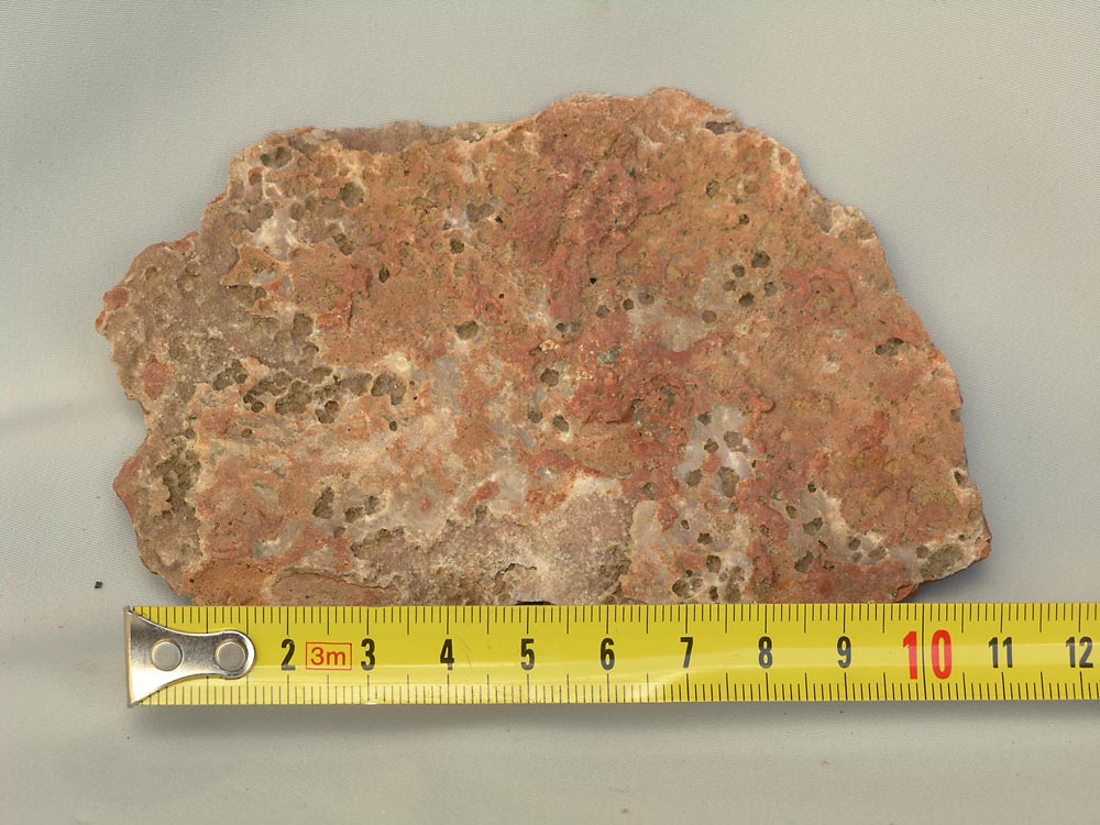
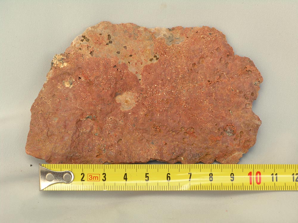
A further type of rock exist here, but is not very common here. The same type has been found in the Lake Flosjö-astrobleme and is shown there in Fig. 13. On the first sight it looks like red porphyry, but it is not a porphyry, because completely free from free quartz and therefore a syenite. Its texture looks by free eye as a melt; at 10 times magnification one sees that the matrix consist of inter-grown feldspar crystals with local cleavage. The colour is deep red-brown, like microcline from mylonite. A tentative explanation of this rock is the following: The impact of the falling meteorite has pulverised the bedrock and created high local temperatures. Steam leached this slurry, removed quartz (therefore so much quartz annealing at other sites) and left the pure feldspar slurry to recrystalize. This red-brown rock is found at sites of astroblemes, only. The hypothesis explains, too, the heavy occurrence of free quartz at (Pos. Aq) in the Siljan-astrobleme, where blocks of several hundreds of kilograms of pure milky quartz can be seen.
 |
| Fig. 29: Pink grey parts: Melt; light parts: Damaged original granite (Pos. Ap). |
 |
| Fig. 30: Red-brown melt and reconstructed granite (Pos. Ap). |
The most convincing evidence for an astrobleme are blocks rich in melt (see Fig. 30 and Fig. 31). They occur scanty, but can be found. Those, this author has found, contained very much melt, which is completely different from that at other sites. Due to a rich content of tiny black particles the melt is gray. The particles – size some tenths of a millimetre – look like hematite, but are magnetic (= maghemite). Some parts of the quartz layers are dyed pink like by erythrine. Diffraction analyses, made by Riksmuseet (Doc. Skogby) showed, that the pink layers consist of the mineral piedmontite. Black dikes appear, too.
Having compared the melt from Lake Siljan och that from Lake Hummeln nobody can claim, that they are identical. Therefore the latter must be genuine and autochtonous, which proves, that Lake Hummeln is an astrobleme of its own. Possibly – due to its small size – the falling body did not evaporate completely and therefore the chemistry of the impact process is another here; we see here remains of the falling meteorite.
 |
| Fig. 31: Left part: Cracks in the solid roof, filled with melt. Right part: Dots of residual eutectic melt. |
There is a further peculiarity, to be mentioned: Most of the granite there must have been partly melt right through, having the appearance like pea-soup. The peas were the grains of quartz and feldspar (microcline and albite) and the soup was the liquid phase. During cooling part of the liquid phase crystallized upon pre-existing crystals, until the eutectic composition has been reached and the remainder of the melt solidified instantaneously. Patches of 5 to 10 mm of the brown eutectic melt are seen everywhere, see Fig. 30 and Fig. 31 (right part of figure). This liquid was at the bottom of the crater; its surface finally solidified, like the surface of a magma lake in a volcanic crater. Slides or other tectonic movement has cracked the solid surface, the underlying (near eutectic) melt poured up and filled the cracks, see left part of Fig. 31, but also Fig. 29. Between the instant of meteorite fall and filling cracks in the solidified surface there can be many years. Due to fast cooling this second melt is very fine-grained and does not contain fragments of the side-rock, like in the samples from the Lake Siljan astrobleme.
 |
| Fig. 32: Even blocks of dolerite, which happened to be at the site of impact, have been remelted and form a sharp zigzag border with the partly melted granite. |
Fig. 33 from the Hummelsjö-astrobleme shows a large piece of granite, containing fragments of pieces of flint-like rock. The flint has been broken into fragments by an instantaneous melt, that has enclosed the flint. There is no sign of melting or digestion of the flint, like it is seen in other sites, where a granite magma advances and gradually digests the country-rock. Compare this figure with Fig. 8a from capture 7.2. In the Hummelsjö-sample the granite was not completely melt, but consisted of crystals, floating in a partial melt. In the former Lake Stora Flaten-sample Fig. 8a the melt was hotter and formed a single phase liquid.
One kilometre south of the astrobleme site there is a hydropower-station in the river Västerdalälven. Here - downstream the dam - large areas of the bedrock are exposed. No trace of impact-affected rock is seen. Therefore the Hummelsjö-astrobleme has to be a small one or lying mainly to the north of the power station and has nothing to do with the recently discovered Rågsveden-astrobleme, which is at about 7 km to the west.
 |
| Fig. 33: Partly melted and afterwards recrystallized granite containing pieces of flintlike rock. |
A recent find – see Fig. 33a – shows the in time different processes in this astrobleme. The brown melt right in the picture, which solidified first, was intruded by a thin (in the picture horizontal) quatz-vein. Next a semifluid ‘paste’ engulfed the brown piece, solidified finally. Last a quartz-vein of different color broke through the now solid ‘paste’. Probably in time different pulses of quartz-solution used the same fissure and deposited their color. Between two of these a lens-like residue from the ‘paste’ is seen. This shows that – hidden by a cover - there existed different melts long after the impact. Compare this with Fig. 33.
 |
| Fig. 33a: Melts of different melting point within the same sample. Coin 25 mm diameter. |
7.11 THE SUPPOSED LAKE ORE-ASTROBEME
SE of the village Furudal (Pos. Ay) there are two interconnected lakes with name Oresjön and Södersjön. Both are rather circular and therefore object of our interest. The centre of Oresjön is at (Pos. Az) and that of Södersjön at (Pos. Ba). The radius of the former is 1,3 km, that of the latter 0,7 km. They are situated within the ring dike of the Lake Siljan-astrobleme.
After retreat of the last ice-cover the river Oreälv had its pass right through the lakes to the south, reached finally Lake Siljan at a place, where later the town of Rättvik has been founded. Enormous glacifluvial deposits fill the former stream valley; the depth of these deposits is at least 20 meter. This is seen in holes of up to 100 m crest-diameter, formerly filled by icebergs. Maybe by uplift of the land or by damming of the former flow at Furudal the river Oreälven took a new pass to the west and now is discharging its water into Lake Orsa.
The above two round structures are too large to be floating icebergs. Running water would have cut them to stripes, like seen in the valley west of Gärdsjö. Therefore they could be small astroblemes, simultaneous falls with the large Siljan impact. In that case during ice ages the craters have been filled with ice. Running water on top of that ice cannot deepen it more than to the local erosion base. Afterward, certainly the ice gradually melted away and has left two deep pits. We do not know the depth of the lakes: A sounding and construction of a bottom profile (best to the solid rock) would be valuable for resolution of the question. Deep holes would indicate astroblemes.
There the bedrock of the whole area nearby consist of a light gray to white fine-grained sandstone from the Silurian, called Orsasandstone. The stone is very uniform in colour and texture.
From the (Pos. Bb) starts a hardly visible carriageway heading east, enclosed by walls of amelioration stones, picked by farmers from the ground. There in the beginning are several blocks of the local sandstone, which actually are breccias, containing fragments of different red dyed sandstones, see Fig. 34; the left sample is the shattered sandstone, the right sample the unaffected sandstone from nearby. There is no doubt, that these fragments of a catastrophic event have been compacted to a new rock. Only an impact can do this. Now the question is: Which impact - The Lake Siljan astrobleme or the supposed small astroblemes in Lake Ore?
However, there can be another explanation: In the sandstone quarry at Kallmora in the northern part of the Siljan ringdike there exist similar sandstones with inclusions of dried clay, evidently transported there by wind. In Chapter 8. this question will be discussed more in detail under the heading ‘An attempt to understand the origin of the
Orsa-sandstone’.
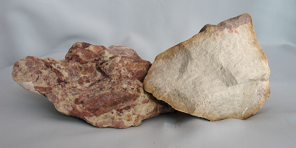 |
| Fig. 34: Right part: Undamaged Silurian sandstone from nearby. Left part: Same sandstone after catastrophic event. |
There is one interesting observation more. At (Pos. Bc), in the middle of local sandstone, there is a ridge of granite, about 200 meter long and 15 meter high, heading 12°E. Since it is parallel to the local perimeter of the supposed astrobleme Södersjön, it could be a spall from that and not from the Lake Siljan astrobleme; the heading of this ‘spall’ is at 90° to the perimeter of the Lake Siljan astrobleme.
The above findings indicate, that the two small lakes very well could be astroblemes, too.
7.12 THE SUPPOSED RÅGSVEDEN-ASTROBLEME
During summer 2010 a further site of a supposed astrobleme has been recognized south of the village Rågsveden. Nothing in the topography of the landscape tells of an impact there, but instead finds of impact-affected samples in the local moraine. This site is in line with the other sites of astroblemes, i.e. in the left end of the stray-ellipse. The samples found are a bolder of breccia, welded together by a brown melt, boulders penetrated by a quartz-rich melt and boulders evidently containing residues of a slate, together with granite fragments. As known, the series of Ordovician rocks contained a layer of shale, too, the s.c. Tretaspis-shale. Positions to localize the finds are:
- (Pos. Be): Start at that point on an about 1 km long forest road, heading south. Along this road (in the sand of the ditches) finds can be made.
- (Pos. Bf): Crossroad there. Take the road to the south. After
- 1 km new road to west. After 200 m
- (Pos. Bg): Cut through a sand ridge; here the slate-containing samples easily are found.
- About 1,5 km to the South at (Pos. Bh) no trace of impact damage is to be seen. Evidently the supposed Rågsveden-astrobleme is very local one.
Note that in the environments there are very large (size of a small home) local boulders. This has been observed at several other astroblemes:
Evidently the bedrock has been shattered by the impact; later on it cured, but broke up at old cracks again during glaciation.
Both at the Hummelsjö-astrobleme and at the Rågsveden-astrobleme, too, samples showing a quartz-rich greenish melt can be found. Evidently this is a melt formed from little water and plenty of different rock minerals at some time after the impact. With other words: It is not a late hydro-thermal impregnation of the bedrock with water-transported quartz!
7.13 THE SUPPOSED KVIEN-ASTROBLEME
The former natural lake Kvien is now dammed and used as a water reservoir for a hydropower station on its southern end. The distance of the power station to the nearest town Malung is 30 km and the distance to the centre of the Siljan astrobleme 95 km. The lake Kvien is narrow and 15 km long, has by no means the appearance of an astrobleme. The heights difference between the lake level and the exit level in the power station is about 20 meter. The coordinates (Pos. Bk) of the northern dam are: 138940E/679435N.
The dam is built from locally blasted rock; we do not know, if there is a particular quarry for this rock or if material from the blasting of the tube has been used in the dam. Probably the latter is the case. The power station is fully automatic, there is nobody there to be interrogated. The core of the dam certainly consist of clay and gravel from some nearby gravel-pit. This core is not visible, is completely covered by the blasted stone.
Already several years ago this author has reacted on the strange type of visible stone. Now, in connection with the discovery of a series of supposed astroblemes on a line from SW to NE he returned to Kvien, since this site lies more or less on that line.
Two types of stones prevail:
-The first is a heavily sheared stone with gliding planes (here brown tachylites), with gliding planes at a distance of some few millimetres. The gliding lengths cannot be determined, can be centimetres. The basic material is rich in quartz. Fig. 3 from the Siljan-astrobleme shows this type of gliding. Fig. 35 from Kvien is the equivalent of Fig. 3.
-The second type is a brown stone, containing substantial quantities of a melt phase on both sides of an intruding quartz vein. This is seen in Fig. 36. Figures 37 and 38 are the opposite sides of the same sample. Also here by visual inspection melt material is seen. This type of material is not as common as the tachylites.
 |
| Fig. 35: Sheared stone sample with tachylites from Lake Kvien |
 |
| Fig. 36: Melt (pseudotachylite) from Lake Kvien |
 |
| Fig. 37: Melt from Lake Kvien |
 |
| Fig. 38: Rear side of sample Fig.37 |
It is known that previously there has been a pressing of more westerly rock massives with a force vector pointing easterly. This effect is seen in the sandstones (quartzite) near Malung. These are bent or raised up to vertical position, but not sheared. This effect could explain the tachylites, but not the massif melts in the second type of material. Therefore the question of the origin of these peculiar rocks is unresolved.
About 0,5 km from the dam there starts quite different rocks, a granite with very large brown red microcline crystals. Due to the load of the Holocene ice-sheet this granite has been cracked in very large blocks, the largest of these measuring about 20x10x8 meters.
8. AN ATTEMPT TO UNDERSTAND THE ORIGIN OF THE ORSA-SANDSTONE
The preset study has let to a spin-off, viz. to the understanding of the origin of the Orsa sandstone. Since this sandstone is completely free from fossils, it could not up to date be placed in time scale; however, it is allocated to the Silurian. According to studies by professor Thorslund there is a substantial gap in time between the highest known sedimentary horizon and the Orsa sandstone. In fact, the Orsa sandstone belongs to the Lower Devon and has been formed by the Siljan impact 377 million years ago.
Let us investigate the facts:
-The Orsa sandstone is free of fossils
-The purest samples consist of white quartz grains and a varying content of calcite (right part of Fig. 34). Other samples, particularly those from the quarry at Kallmora, are dyed red-brown of different shades. Even rose samples, dyed by pulverized microcline occur; see Fig. 39 . Further there occur samples, rich in fragments of dried clay; these fragments have no order in-between, see Fig. 40. There exists a mix of dyed and white sandstone, too, see Fig. 41. Evidently volumes of heavily dyed loose sand got in contact with another volume of white sand.
 |
| Fig. 39: Orsa sandstone from Kalmora. Upper part: Undyed white sandstone. Middle part: Sandstone dyed by pulverised microcline |
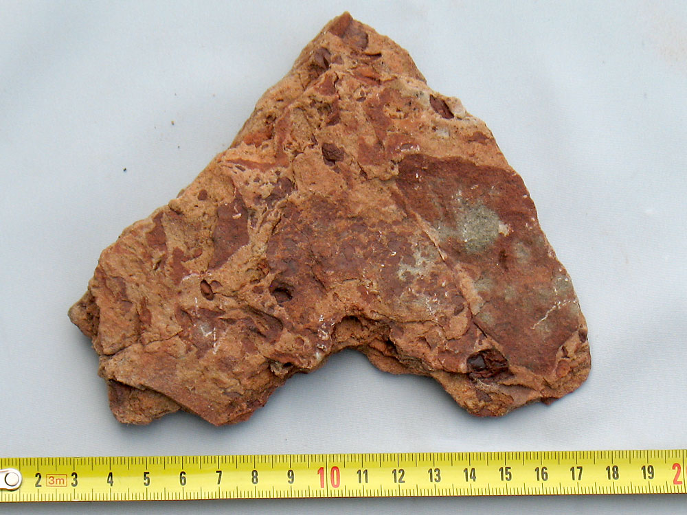 |
Fig. 40: Orsa sandstone from Kallmora. Light brown background: Mixture of the dying agent and white qurtz. Dark brown spots: Residues of the clay formed in depressions before the avalache, that mixed the unconsolidated airborne sediments |
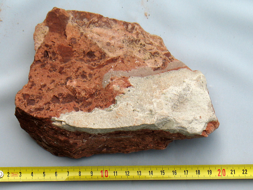 |
Fig. 41: Orsa sandstone from Kallmora. Three grades of brown sandstone, in contact with white massive white sandstone |
The geological regional map /13/ around the astrobleme shows a ring dike of Ordovician and Silurian sediment, that have been preserved in the dike formed by the impact, described by Melosh /11/ as a ‘peak ring crater’ in his Fig.8.14 (b). The whole ring consists of three part-rings: The innermost consists of Ordovician calcite, the middle one of the Orsa sandstone (treated her) and the outermost of Ordovician calcite again.
Further away from the impact no Orsa sandstone does exist. In the inner carbonate ring the originally horizontal calcite sheets are raised to a steep angle; in the outer ring they are slightly tilted, only. There seems to be a trench between these two carbonate rings, filled-up with the sand, later forming the sandstone. This trench can be seen going around the centre of the astrobleme all the way round.
Some important finds are the key to understanding the formation of the Orsa sandstone:
At the beach of Lake Siljan, below the cementary of Rättvik, there are several boulders of calcite and of a mix of calcite and Orsa sandstone. This site can be reached at low-water in Siljan, only. These boulders are not original, layered and fossiloferous Ordovician calcite, but reconstructed calcite, formed from - during the impact - pulverised calcite. This secondary calcite contains different amounts of small quartz grains, as shown in Fig. 4b.
By the same token there exists a reconstructed sandstone, formed from
A) previous sand layers (sediments between Ordovicium and Lower Devon) or from
B) the shattered granite in the center of the impact.
From Fig. 1 it is evident, that also the granite in the basement below the cover of later sediments has been affected very much. In the centre the sediments and the granite have been evaporated, crushed to powder and blown up into the atmosphere, together with droplets of melt. Hours later this atmospheric load started to fall out, larger particles first, the smallest last; carbonate particles below quartz-particles. This process may have taken weeks and month.
It is known from/13/, that below the Orsa sandstone there is a conglomerate layer. In our explanation then followed quartz fragments and finally what was left of the droplets of melt, now of course in solid form. The landscape probably looked like snow in the Alps, the upper surface of the ‘snow’ somewhat dirty. The dirt reacted with rainwater and has been transformed into a red-brown clay, which collected in depressions and dried up there.
At that instant the new sediment had no firmness at all, avalanches started easily like snow in the Alps. These avalanches mixed the originally white sand sediment with flakes of the dried clay in a chaotic manner. Also slightly consolidated volumes were mixed up, giving a primordial stone, where reconstructed calcite is mixed up with reconstructed sandstone. Such samples have been found at Rättvik on the beach, look like intercalated hands, where fingers of the one hand are intercalated with fingers of the other hand, see Fig. 42 and 43 (IMG_2016 and 2018).
These figures show the front side and the rear side of the same sample. Note, how distinct reconstructed calcite is separated from the sandstone.
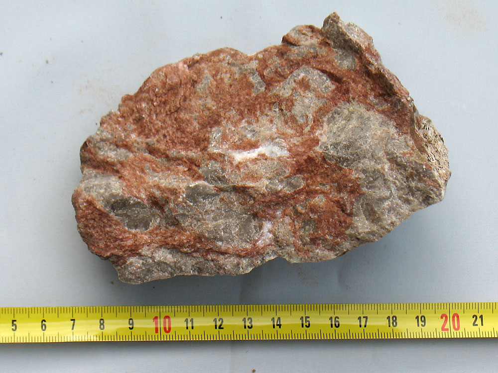 |
Fig. 42: Pieces of reconstructed brown Orsa sandstone and reconstructed grey limestone. The whole material has been pulverised during the impact. Fresh broken surface of same sample as in Fig. 43. |
 |
Fig. 43: Same sample as in fig. 42, but surface exposed to erosion. Pieces of reconstructed limestone separated from reconstructed Orsa sandstone |
This is the final proof that reconstructed calcite and Orsa sandstone are contemporaneous and formed by the impact of the Siljan meteorite.
The clay particles may contain residues from the meteorite, t.ex. iridium or some other unusual element. The Chicxulub meteorite has been detected by clay-samples from Italy and Denmark, too.
Dyed samples of the Orsa sandstone may show bleaching dot, up to a centimetre wide. The reducing agent is of course carbon in some form. The carbon may very well be of terrestric origin; however, it could also be of meteoric origin, from a CI-chondrite. Therefore even the centre of the bleaching dots should be examined for unusual elements.
9. DISCUSSION
About 377 million years ago a large meteorite hit the central part of the present County Dalecarlia in Sweden. To day we know the size of the crater (figures like 52, 65 and 75 km diameter of the outer rim of the crater have been mentioned); however, we do neither know the kinetic energy, nor the mass, the composition (density), the diameter or the speed at touch-down. Estimates of these data in literature are pure guesses.
Certainly its mass, diameter and speed must have been substantial; such meteorites get instantly heated by their compression and evaporate completely. Therefore we never will be able to disclose the nature of that meteorite.
Stony meteorites consist of cosmic debris, of minor particles bound together to a body by mass forces only, not by chemical forces like in a solid body. Therefore such meteorites have the tendency to crack into smaller pieces during passage through the Earth’ atmosphere. As an example the very young Chiemsee-fall (Bayern, south Germany) can be mentioned. It is so new, that originally the minor craters, that had been observed here and there, have been interpreted as lost bombs after bombarding of Munich during the Second World War.
Lake Siljan
Field evidence points towards that the fall of the Siljan meteorite was not an isolated event, but consisted of a shower of simultaneous meteorites, fragments of the original meteorite. Such showers lie always along a line, like in the Chiemsee-fall. To day we can study the - by weathering grossly modified - remnants of a meteorite fall; we call the damage astrobleme.
This author has during many years studied the Siljan astrobleme and thus attained a solid knowledge of the rocks formed instantly by a fall and those formed later in the debris due to the residual heat, lasting hundreds of years (depending on the size of the impact).
New rocks are formed in the seconds of the impact, during the following years, when the unstable crater rim slides down into a water-filled ring-dike and even later in the melt or semi-melt, covered by debris in central parts of the impact.
As a physicist this author also knows a lot on the mechanism of the impact – the first seconds after touch-down – which is useful to understand the formation of the different rocks at different instants and sites.
Other astroblemes
With the experience from the Siljan astrobleme he started to study a peculiar site north of the town of Dala-Järna, where several oblique lakes formed a system of an interrupted ring dike. Soon the same or similar rock samples have been discovered, which indicated, that this ring could be an astrobleme, too. In this report he has given the coordinate of all sites, thus everybody can convince himself of their existence. The rocks are there! Somebody may propose, that they have come there from the Siljan impact by other geological processes like having been thrown there or transporter there by Quaternary ice transport. This point will be discussed later in this chapter.
With this experience it was easier to discover other sites, like the Dala-Floda astrobleme, that belonging to Långsjön and that SW of Vansbro near Hummelsjön. This latter is the one, which is richest in finds: Practically every bolder there is affected by that impact.
All the finds lie along a line from SW to NE between the village of Rågsveden in the SW and the Lake Balungen in NE.
Size of the area of astroblemes
At most sites the bedrock is covered by till from the latest glaciation; practically all samples have been found in the till. Even there it is difficult to find something, because – due to the high humidity - all boulders here are covered with moss or lichen. Only there where a forest fire cleaned the stones or where forest-ploughing has unearthed ‘clean’ stones, which can be inspected.
Therefore even within the Siljan astrobleme it is difficult to find signs of the impact: One has to look for areas of forest fires, forest ploughing, beaches, amelioration piles, river beds, gravel pits and road sides, where blasting has taken place. The same is of course true for all other sites.
Therefore a site can be much larger, than we can see it: The peripheral parts disappear below moss and lichen.
Sediment burden at the instant of impact
At the instant of impact 377 million years ago the bedrock was covered with sediments from the Ordovician, the Silurian and the Lower Devonian. Thorslund /5/ estimated the thickness of the Ordovician in Dalecarlia to 130 m. Petalas /6/ has studied the sedimentary petrology of the Orsa sandstone. Randot /7/ estimates the thickness of the whole burden up to the impact to 500 m. Grieve /8/ up to 1000 m, Collini /9/ and Lindström /10/ up to 2000 m. Therefore much of the impact energy has been lost in these sediments. During the past 377 millions of years these have been eroded by weathering. To day we are looking on a bedrock surface, which is even lower than that surface at the instant of impact.
With other words: We are looking on a deep level of the astrobleme! Still there is very much to see, e.g. previously melt rock!
Effect of long-time heating to high temperatures of deep volumes
As mentioned earlier, heat is not only generated by the reversible adiabatic compression of the rock during the seconds of the impact, but also due to the irreversible friction between fragments of the rock. Since shattered granite is a poor conductor of heat this heat stays for very long time. E.g. in combination with supercritical steam, quartz is dissolved and transported to cooler regions; therefore are the samples from around Trollberget in the Siljan astrobleme, containing thick ‘schlieren’ of melt, free of visible quartz. It is this quartz that on a higher level glued together the shattered fragments to a solid rock, free from cavities to host abiogenic gas.
Samples from the Lake Hummeln astrobleme show, that the previous melt must have had the structure of a pea-soup: Still solid crystals of microcline and some quartz are seen to be floating in a liquid phase (the eutectic water-quartz-microcline-muscovite).
PDF as a means for safe detection of an impact
PDF = Planar Deformation Features are deformations in feldspar or quartz, generated by a passing wave of very high pressure. Microscopic parts of the quartz crystal are displaced from their normal position in the lattice. This defect can be seen on 30 micrometer thin samples, inspected by the mineralogic microscope with parallel or antiparallel polarizers. If present, they are a very clear sign for very high pressures, attained in impacts, only. The PDF’s cannot be seen in advance by eye or with a magnifier. This makes the selection of samples for preparation for the expensive micromounts a hazard. Further, there is the risk, that the above-mentioned long-time heating of the rock has annealed a sample, which originally had PDF’s.
Therefore: Existing PDF’s are a reliable proof for the sample to originate from an astrobleme. Missing PDF’s do not tell anything: The sample has nothing to do with an astrobleme or it originates from one, but for the above reasons is free from PDF’s.
Iridium in samples
Iridium on Earth is a very rare element, but is more frequent in space. Therefore prove high concentrations of iridium in suspected samples, that these originate from an astrobleme. Again, missing iridium does not tell anything: Either the suspected sample does not belong to an astrobleme, or it does, but the meteorite did not contain iridium.
This author has no access to micromounts, a microscope for photography or to iridium-analyses. Therefore the above proofs could not been done. However, he has carefully compared astrobleme-samples from the Siljan with those from the other supposed astroblemes and accepted the verdict ‘astrobleme’ at complete coincidence of the samples, only.
At some of the supposed astroblemes the quantity and quality of the samples is not sufficient, at others it is very good.
For example: To my opinion the supposed astroblemes Dala-Floda, Dala-Järna and Hummelsjön are real astroblemes. This makes several of the others very probable.
Reconstructed rock
During the instant of impact the basement rock is shattered and partly pulverised. Later on (during years to thousands of years) this debris forms new rock. This is the meaning of the term ‘reconstructed rock’. There are two types of reconstructed rock: One is formed at or near the surface, the other at depth.
Formed at the surface: The impact pulverises previous rocks near the surface; in our case this will be the sediment above the basement rock and some granite. All previous textures like fossils or Ordovician discontinuity surfaces have been erased. Due to friction in the dust cloud grains of quartz can assume the shape of lenses. After settlement the mixture of quartz (from Silurian and/or from the granite basement) and calcite (from Ordovician) forms a new rock, free of all previous texture. Blocks of this type of rock are found in spring (low water level in the lake) at the shore of Lake Siljan, below the graveyard at Rättviks church, see Fig. 4b or Fig. 27a or Fig. 27b. In front of library at Rättvik there is a large calcite boulder of that reconstructed type exposed, too.
Formed at depth: At depth the previous rock (here mainly granite) is shattered to fragments. Since this region is very hot for very long time, microcline crystals grow in size by consuming smaller ones. A size of 5 cm is not uncommon. Between the grains of the shattered rock there is an eutectic melt, that finally solidifies, see Fig. 14 and Fig. 16a. Quartz is distilled off.
Inclusions of calcite
In the Lake Stora Flaten- and in the Lake Flosjön-astrobleme at several locations pieces of reconstructed rock (granite) have been found that contain some cm3 large fragments of the Ordovician calcite. Note: These are isolated fragments, not later impregnations with dissolved calcite. See Fig. 8a and Fig. 16b.
This should be a far better proof of an astrobleme origin of these samples than PDF, because PDF can anneal and disappear, but calcite inclusions not.
Large boulders in the moraine
As previously mentioned, locally in depressions there are accumulations of local boulders with sharp edges (hardly any transport distance). These seem to be more frequent here than in terrain, not hit by a meteorite. However, this is not a very strong evidence for an astrobleme, but has to be noted. The area one to two kilometres south of (Pos. Bm) is just such a site.
During times of glaciation (a larger number of glaciations have taken place) an ice sheet of one or two kilometres of thickness slowly moves over the bedrock, transporting away any rock broken off the bedrock. The latter is most ground at elevated positions, creating polished, smooth hillocks. This is the standard situation: Morain in depressions and polished tops of hills.
Therefore it is astonishing to see at sites of astroblemes hills, on their top covered by large, sharp fragments of the underlying rock. The following positions are just an example: Pos. K, Pos. Bl, and Pos. Bm. A plausible explanation for this fact might be: At these sites the original bedrock has been deeply shattered by the impact of a meteorite. During geological times between 377 million years ago and to day first the sedimentary overburden has been removed by weathering and recently several tenths of meters by repeated glaciations. Towards the end of the last glaciation – during retreat of the ice sheet – the ice-tongue lost contact with the remaining ice sheet to the north, had changed to a ‘dead ice’; this no longer moves. However, the temperature is still around zero Centigrade. Melt water penetrated and filled the old cracks; freezing during night bent loose the blocks, which remained resting at that site.
Similarity between samples from different sites
Lake Siljan: Concerning samples of pure melt these have been up to date found in the till, only, not in outcrops. Such outcrops probably exist, the fragile material has been broken off during the latest ice-age. In these samples the melt phase consist of a fine-grained matrix, greyish or brown in colour, with included pieces of burned granite. No free quarts is to be seen in either the melt nor the enclosing burned granite. This quarts has later (years and thousands of years later) been distilled upwards and filled all fissures in the shattered overburden, now exposed.
Inclusions of calcite have not been found in Siljan.
Reconstructed rocks, consisting of calcite powder (from Ordovicium) and quarts sand (from Silurian) are found at Rättvik. These samples are completely free from fossils. One large sample is shown outside the City Library.
Lake Flosjö: Near and on top of Bodberget (Pos. N) plenty of minor and larger boulders can be found, which consist of shattered granite, percolated by a dark melt, to day consisting of chlorite. This type of melt has not been seen in the Siljan-astrobleme.
At the centre of this astrobleme at (Pos. Q) boulders may be found, containing a dark brown melt, but in other samples also containing a black glassy melt. These dark melts do not occur in Siljan.
Several inclusions of calcite nodules in the shattered ‘granite’ have been found.
Lake Snesen-Storflaten: Plenty of brown, homogeneous melt found, enclosing crushed pieces of the bedrock. Evidently this melt has been pressed from a distant point into a heap of crushed stone.
Inclusions of calcite are found, too. These are seen inside recently broken samples, only. Other samples show on their surfaces cavities, which once had been filled by calcite, which now has gone. These calcite nodules are not late dikes, but are splinters of Ordovician limestone, created during the seconds of the impact.
SW of Vansbro: This site is very rich in all sort of material: Melts, reconstructed ‘granite’, sintered ashes, two generations of melts in contact with one another. This observation has been explained previously in this paper. We have not seen it in the other sites.
In none of the astroblemes mentioned here outcrops of melt have been found. The only suspect place for this is the top of the hill Bodberget: There the bedrock consists of a ‘granite’, consisting of about 50% albite and some quarts and of 50% dark minerals like biotite and hornblende. Such a high content of dark minerals is not known from normal granite. Could this granite be a ‘reconstructed rock’, having received material from the vaporizing meteorite? If the falling meteorite had been a so-called CI-chondrite, this would support the hypothesis. These CI-chondrites contain large amounts of water, organic compounds and of hydrous phyllosilicates.
One feature, common to most of the sites from Lake Kvien in SW to Lake Ljugaren in NE should be mentioned: The existence of very large orthoclase crystals in granite. These may be 50 times larger in volume than the average orthoclase crystals nearby! A tentative explanation is the following: Due to the residual heat after the impact the granite in question has been heated for tens and hundreds of years. Even without partial melting the mobility of the ions is orders of magnitude higher than at room temperature, smaller crystals are ‘eaten up’ by larger ones. If partial melting has occurred, the ion-transport is still faster. Crystals of up to 5 cm length have been seen. The southern side of Lake Ljugaren consists of such granite.
How could astrobleme samples, originating from the Siljan astrobleme, reach the positions of the supposed astroblemes?
Since several scientists of the Swedish geological community evidently believe this, I have the task to test these possibilities. In principle there exist two ways, only, to move samples from the Siljan astrobleme to other sites in Dalecarlia:
- The samples have been thrown there and to all other locations around the Siljan astrobleme during the seconds of the impact
- The samples have been transported from their original sites according to A) to the present downstream locations during the latest glaciation
Let us test the feasibility of these two modes:
Mode A). For nearby locations this mode could be possible. However, these projectiles do not have cosmic speed, but more terrestric speed and will not penetrate the thick cover of young sediments to any depth. Since we during the following 377 millions of years have lost between 1 to 2 km of sediments by erosion, it is completely impossible, that inherently weak casts – located within these sediments – should have survived a series of may-be ten glaciations.
Mode B). The glacial ice in Dalecarlia was flowing from NNW to SSE. Taking the richest and most distant location – the astrobleme at Vansbro, south of Hummelsjön, as an example - we cannot imagine, how the ice flow should change its direction by 90˚, deposit a lot of stones from Siljan within a very limited location and then turn back again into the normal ice-flow direction. Rather it is so, that the bedrock at that site contains the roots of a local astrobleme and the ice-flow has broken free the boulders, we see today.
There is one more important argument for the supposed local origin of the collected samples far away of Lake Siljan: Samples – thrown there by the impact – behave like stone in a quarry during blasting: There is no time to change in chemistry or composition! These ejecta may be crushed, but are never sealed by quarts or melt. Sealing is a much later process in the history of an astrobleme.
By these arguments I believe to have demonstrated, that the supposed astroblemes outside Siljan have to be real ones.
ABOUT THE AUTHOR
The author is PhD in physics from the Technical University of Stuttgart and BS in geology from the University of Uppsala. Today he is retired. During his active time he has worked at ABB in Ludvika with research on the physics of material for transformers. As geologist he has worked for LKAB Prospekterings AB and teaches Geosciences for local laymen.
ACKNOWLEDGEMENT
This author thankfully acknowledges the great help by mineralogical analyses of samples from the astroblemes by docent Henrik Skogby from the Swedish Museum of Natural History in Stockholm and from discussions with professor Thomas Lundqvist.
BIBLIOGRAPHY |
|
| /1/ | W.U. Reimold et al: Laser argon dating of melt breccias from the Siljan impact structure, Sweden, Meteoritic & Planetary Sciences 40, Nr 4, 591-607 (2005) |
| /2/ | C. Koeberl: Mineralogical and geochemical aspects of impact craters, Mineralogical Magazine, October 2002, Vol. 66(5), pp.745-768 |
| /3/ | H.S. Carslaw and J.C. Jaeger: Conduction of heat in solids, Second Edition 1959, Oxford, At the Clarendon Press |
| /4/ | R. Liljequist: En sten på marken skall man inte förakta, Geologiskt Forum Nr 49 (2006), pp.10-13 |
| /5/ | P. Thorslund and V. Jaanusson: The Cambrian, Ordovician, and Silurian in Västergötland, Närke, Dalarna, and Jämtland, Central Sweden Publication from the Paleontological Insitution of the University of Uppsala, No. 30, July 1960, p.25 |
| /6/ | Petalas, C. 1985. Sedimentary petrology of the Orsa sandstone, central Sweden. UUDMP research report 40, 1-138. University of Uppsala, Institute of Geology, Department of mineralogy and petrology ÖV: Master thesis. |
| /7/ | Rondot, J., 1976: Comparaison entré les astroblemes de Siljan, Suéde, et de Charlevoix, Quebec. Bulletin of the Geological Institutions of the University of Uppsala 6, 85—92. |
| /8/ | Grieve, R.A.F., 1984: Constraints on the nature of Siljan as an impact structure. Department of Energy, Mines and Resources, Internal Report 84, 15. |
| /9/ | Collini, B., 1988: Geological setting of the Siljan ring structure. In A. Boden, K. Eriksson (eds.): Deep Drilling in Crystalline Bedrock; Vol. 1: The Deep Gas Drilling in the Siljan Impact Structure, Sweden and Astroblemes, Proceedings of the International Symposium, 349-354. Springer Verlag, Berlin. |
| /10/ | Lindström, M. & von Dalwigk, L, 1999: The Siljan meteorite impact: stratigraphic constraints. EUG 10, 28th March - l" April 1999, Strasbourg, France, Journal of ConferenceAbstracts 4, 268. |
| /11/ | Melosh, H.J.: Impact Cratering, Oxford University Press, New York Clarendon Press, Oxford, 1989 |
| /12/ | Lundqvist, T. & Svedlund, J-O: Dokumentation av breccior och andra bergarter i norra Dalarna (Documentation of breccia and other rocks in northern Dalarna) SGU-rapport 2009:01 |
| /13/ | Hjelmqvist, S., Beskrivning till berggrundskarta över Kopparbergs Län, SGU Ser. Ca., Nr. 40, 1966 |
COORDINATES OF SITES |
||
(The Swedish National Grid RT90 is used here) |
||
| Pos. A | Lake Siljan astrobleme. Location not disclosed here. | |
| Pos. B | 144640E/675580N | Garsås, gravel pit at railway |
| Pos. C | 144620E/675470N | Garsås, beach |
| Pos. D | 145425E/675125N | Stumsnäs, pier |
| Pos. E | 142580E/672525N | Centre of Lake Stora Flaten-astrobleme |
| Pos. F | 143210E/672525N | Departure from public road to Långtjärn |
| Pos. G | 143164E/672880N | Långtjärn, at the dead birch |
| Pos. H | 143175E/672980N | Small gravel pit 1 km north of Långtjärn |
| Pos. I | 143210E/672540N | Turning towards end of road |
| Pos. J | 143128E/672652N | End of road |
| Pos. K | 142825E/672280N | Giant boulders at Lake Stora Snesen |
| Pos. L | 143110E/672225N | Gravel pit at Lake Stora Baggbod-Öradtjärn |
| Pos. M | 144250E/671520N | Centre of Lake Flosjö-astrobleme |
| Pos. N | 144945E/671630N | Saddle between Bodberg and Forsbodarna |
| Pos. O | 144930E/671750N | Recently build forest road |
| Pos. P | 144935E/671775N | Ploughed area of deforestation |
| Pos. Q | 144315E/671440N | Old gravel pit at Trolldalarna |
| Pos. R | 144750E/673425N | Hill Tutberget on Harpick-island |
| Pos. S | 143540E/673850N | Centre of Lake Vådsjö-astrobleme |
| Pos. T | 143649E/673780N | Gravel pit inside Vådsjö-astrobleme |
| Pos. U | 143580E/673425N | Gravel pit at north end of Lake Långsjön |
| Pos. V | 143750E/671905N | Slope on west side of Flosjö-astrobleme |
| Pos. W | 143630E/671725N | Protected area west of Flosjö-astrobleme |
| Pos. X | 143970E/673230N | Centre of Lake Långsjö-astrobleme |
| Pos. Y | 143535E/674060N | Turning of road in Lake Vådsjö-astrobleme |
| Pos. Z | 143437E/674099N | Gravel pit in Lake Vådsjö-astrobleme |
| Pos. Aa | 144234E/673060N | Quarry in Lake Långsjö-astrobleme |
| Pos. Ab | 144960E/673790N | Cairn on Storön in Siljansnäs-astrobleme |
| Pos. Ac | 144789E/674043N | Amelioration cairn in Siljansnäs |
| Pos. Ad | 146300E/673950N | Centre of Leksands-astrobleme |
| Pos. Ae | 145546E/673655N | Hill Käringberget in Leksand |
| Pos. Af | 145534E/673771N | Another tilted sheet north of Käringberget |
| Pos. Ag | 145944E/674009N | Amelioration cairn in Södra Torrberg |
| Pos. Ah | 145978E/674026N | Amelioration cairn in Norra Torrberg |
| Pos. Ai | 146970E/674090N | Pseudotachylites near Slättberg |
| Pos. Aj | 146690E/674715N | Quarry at rim of the Leksand-astrobleme |
| Pos. Ak | 147594E/676137N | Beach of lake Ljugaren |
| Pos. Al | 149975E/676950N | Forest road from Svabensverk to Svartnäs |
| Pos. Am | 145945E/672325N | South end of gravel pit at Gräv |
| Pos. An | 146160E/675880N | Limestone quarry with vertical bedding |
| Pos. Ao | 144370E/671720N | Tachylites in a fine-grained granite |
| Pos. Ap | 140965E/670550N | Lake Hummeln, top of deforested area |
| Pos. Aq | 144660E/675475N | Pier at shore of Lake Siljan in Garsås |
| Pos. Ar | 146145E/675295N | Shore at the church of Rättvik |
| Pos. As | 143143E/672829N | Gravel pit in Lake Stora Flaten astrobleme |
| Pos. At | 143786E/673017N | Forest road north of Gäddtjärn |
| Pos. Au | 143710E/672940N | Gravel pit near Gäddtjärn |
| Pos. Av | 142210E/673090N | Shore of Lake Storflaten,west position |
| Pos. Aw | 142250E/673075N | Shore of Lake Storflaten, east position |
| Pos. Ax | 140830E/670625N | SW of road to Hummelsjön |
| Pos. Ay | 146400E/678400N | Community of Furudal |
| Pos. Az | 146540E/678130N | Centre of Oresjön |
| Pos. Ba | 146835E/677900N | Centre of Södersjön |
| Pos. Bb | 146540E/677928N | Amelioration cairns along carriageway |
| Pos. Bc | 146750E/677940N | Granite ridge (eventually spall) |
| Pos. Bd | 143639E/673074N | To the west of this point samples |
| Pos. Be | 140218E/670598N | Start of forest road to south |
| Pos. Bf | 140195E/670595N | Crossroad |
| Pos. Bg | 140182E/670500N | Cut through sand ridge |
| Pos. Bh | 140223E/670346N | New forest road heading East |
| Pos. Bi | 147260E/676240N | Start of forest road to (Pos. Bi) |
| Pos. Bk | 138940E/679435N | Northern dam at Lake Kvien |
| Pos. Bl | 143130E/672860N | East of Lortjärnarna |
| Pos. Bm | 144275E/671640N | South of Lake Gysjön |
Download printable complete version in pdf-format (24 MB)
© 2014-07-21 Erich Spicar